Winter weather returns to New Mexico Wednesday through Thursday
[anvplayer video=”5090114″ station=”998127″]
ALBUQUERQUE, N.M. — Two upper-level disturbances will impact New Mexico in the short term, one from the west Wednesday and the second from the northwest Thursday.
A strong back door cold front will plunge south through the east Wednesday night with much colder air, while clouds and precipitation will cool temperatures in the west.
Snow will begin in the western mountains Wednesday morning, and spread east and south Wednesday afternoon in the form of mountain snow and valley rain.
Rain will change to snow Wednesday night on the plains and valleys. Snow will linger into Thursday over and near the central mountains.
Snow totals will favor the west and north mountains where generally 3 to 5 inches can fall. Higher amounts of up to 8 inches could fall on the higher peaks of the Sangre de Cristo Mountains. Valleys and lowlands could receive up to 1 inch.
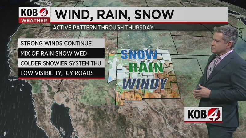
The winds will be the other story with these storms. Southwest winds over the southwest and south central mountains will continue strong tonight, with speeds of 30 to 40 mph with gusts to 55 mph. Winds on Wednesday will focus over the south central highlands across the southeast and east central plains. Speeds will average 30 to 45 mph with gusts to 60 mph.
Temperatures will drop sharply Wednesday and Thursday. A strong back door cold front Wednesday night will blast much colder air down eastern New Mexico Thursday.
Temperatures everywhere will be below to much below normal by Thursday
STORM WATCH
- For the latest conditions, click here
- Find weather alerts here
- Check out the interactive radar
- Learn about the latest road conditions
- Submit photos and videos
If you’re on the go, the KOB 4 Weather App is also available for free on the App Store and the Google Play Store.